MAKE A MEME
View Large Image

| View Original: | 12th-century_map_of_the_Indian_Ocean_by_Al-Idrisi.jpg (550x398) | |||
| Download: | Original | Medium | Small | Thumb |
| Courtesy of: | commons.wikimedia.org | More Like This | ||
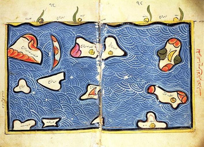
| Keywords: 12th-century map of the Indian Ocean by Al-Idrisi.jpg This 12th-century map of the Indian Ocean by al-Idrisi is so obviously imprecise as to seem almost decorative Note its similarity to the islands of the Indian Ocean in his world map But don ™t fault him for trying It was one thing to be able to sail all the way to China and quite another to explain to a stay-at-home scholar where one had been It is easy to forget what an achievement even a simple map represented Until the 15th century mariners knew maps could indicate relative shapes and sizes but they were nearly useless for navigation NATIONAL LIBRARY CAIRO / GIRAUDON / ART RESOURCE 11th-century map of the Indian Ocean National Library Cairo object history credit line accession number NATIONAL LIBRARY CAIRO / GIRAUDON / ART RESOURCE http //www art-prints-on-demand com/a/al-idrisioredrisi-1/theindianoceanfromanatlas-1 html http //www saudiaramcoworld com/issue/200504/the seas of sindbad htm PD-old-100 Uploaded with UploadWizard Old maps of the Indian Ocean Maps made in the 11th century 12th-century maps of India | ||||