MAKE A MEME
View Large Image

| View Original: | 1850_Mitchell_Map_of_Washington_D.C._^_Georgetown_-_Geographicus_-_WashingtonDC-m-1850.jpg (4000x3234) | |||
| Download: | Original | Medium | Small | Thumb |
| Courtesy of: | commons.wikimedia.org | More Like This | ||
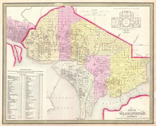
| Keywords: 1850 Mitchell Map of Washington D.C. ^ Georgetown - Geographicus - WashingtonDC-m-1850.jpg This is beautiful hand colored 1850 map of Washington D C Capital of the United States The map covers all of Washington D C as well as parts of adjacent Georgetown The whole is highly detailed with individual buildings noted and color coding to define city wards Some seventy-five buildings including the Capitol the White House the Cemetery the Brewery various markets the Masonic Hall and the Tobacco Warehouse and many others are identified Produced by the American map publisher S A Mitchell Sr from his offices on the northeast corner of Market and 7th Street Philadelphia Pennsylvania 1850 undated Size in 16 12 5 object history credit line accession number WashingtonDC-m-1850 Mitchell Sr S A <i>A New Universal Atlas Containing Maps of the various Empires Kingdoms States and Republics Of The World </i> 1850 issue Geographicus-source PD-old-100 Maps by Samuel Augustus Mitchell Old maps of Washington D C 1850 maps Designs for the United States Capitol Maps in English Washington D C in the 1850s | ||||