MAKE A MEME
View Large Image
| View Original: | 1850_Perthes_Map_of_Bohemia_(_Czech_Republic_)_-_Geographicus_-_Boheme-perthes-1850.jpg (4000x3304) | |||
| Download: | Original | Medium | Small | Thumb |
| Courtesy of: | commons.wikimedia.org | More Like This | ||
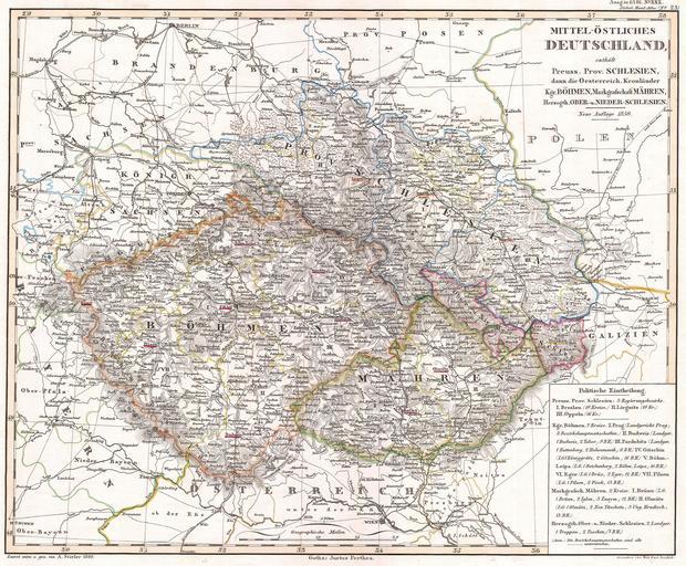
| Keywords: 1850 Perthes Map of Bohemia ( Czech Republic ) - Geographicus - Boheme-perthes-1850.jpg This fascinating hand colored map depicts Bohemia or modern day Czech Republic Includes Böhmen Schlesien and Mahren All text is in German Issued in the 1850 edition of Stieler ™s Hand Atlas 1850 Size in 14 12 object history credit line accession number Boheme-perthes-1850 Geographicus-source PD-old-100 Maps in German Old maps of the Austrian Empire Old maps of Bohemia 19th-century maps of Moravia Old maps of Silesia 19th-century maps of Germany Old maps of the Czech Republic 1850 maps | ||||
_-_Geographicus_-_Boheme-perthes-1850.jpg)