MAKE A MEME
View Large Image

| View Original: | 1862_Johnson_Map_of_Mexico_and_Texas_-_Geographicus_-_Mexico-johnson-1862.jpg (3500x2788) | |||
| Download: | Original | Medium | Small | Thumb |
| Courtesy of: | commons.wikimedia.org | More Like This | ||
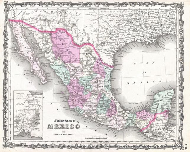
| Keywords: 1862 Johnson Map of Mexico and Texas - Geographicus - Mexico-johnson-1862.jpg A very attractive example of Johnson's 1862 map of Mexico Includes all of modern day Mexico as well as most of Texas Guatemala Belize and adjacent regions Color coded according to Mexican states Depicts Arizona according to the border set by the briefly extant Confederate state of Arizona Also includes some interesting notations such as Uninhabited and isolated maintains without grass wood or waters An inset map in the lower left corner details the Territory and Isthmus of Tehuantepec Features the strapwork style border common to Johnson ôs atlas work from 1860 to 1863 Published by A J Johnson and Ward as plate number 65 in the 1862 edition of Johnson ôs New Illustrated Family Atlas This is the first edition of the Family Atlas to bear the Johnson and Ward imprint 1862 undated Size in 16 12 5 object history credit line accession number s Geographical Statistical and Historical </i> 1862 A J Johnson Ward edition Geographicus-source PD-old-100 Maps by Alvin Jewett Johnson 1862 maps Old maps of Mexico | ||||