MAKE A MEME
View Large Image

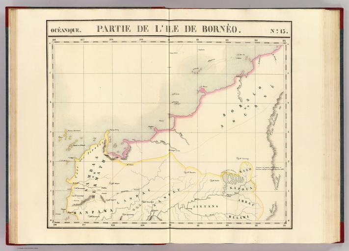
| View Original: | A 1827 map of Northwestern Borneo drawn by Vandermaelen, Philippe.jpg (9584x6906) | |||
| Download: | Original | Medium | Small | Thumb |
| Courtesy of: | commons.wikimedia.org | More Like This | ||
| Keywords: A 1827 map of Northwestern Borneo drawn by Vandermaelen, Philippe.jpg en A map published in Brussels France in 1827 depicting the Northwestern Borneo which includes Sarawak part of Sabah and part of West Kalimantan Among the place names shown in the map are Tanjong Datou present day Tanjung Datu Sarawak<br> Calca present day Kalaka Sarawak<br> C Baram present day Tanjung Baram Sarawak<br> Bourne' present day Brunei<br> Riv Kimanis present day Kimanis river Sabah fr Partie Borneo Oceanique no 13 1827 http //www davidrumsey com/luna/servlet/detail/RUMSEY~8~1~25319~1010027 Partie -Borneo--Oceanique-no--13- Vandermaelen Philippe 1795-1869 other versions Custom license marker 2016 06 18 PD-old-70 PD-US Maps of Sarawak | ||||