MAKE A MEME
View Large Image
| View Original: | América_física_y_política_1840.JPG (1505x1999) | |||
| Download: | Original | Medium | Small | Thumb |
| Courtesy of: | commons.wikimedia.org | More Like This | ||
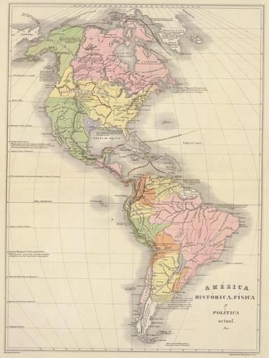
| Keywords: América física y política 1840.JPG es Mapa físico y político de América en 1840 Western hemisphere map 1840; shows Central America united Texas and Paraguay in disputed gray color and the U S as having control over the disputed Oregon territories http //www davidrumsey com/directory/who/Codazzi++Agustin++1793+1859/ Historical Maps by Agustín Codazzi from David Rumsey Website Creator Agustin Codazzi 1840 PD-old Agustin Codazzi Atlas de Venezuela 1840 Old maps of the Americas David Rumsey Historical Map Collection | ||||