MAKE A MEME
View Large Image

| View Original: | AMH-5181-NA_Map_of_southeast_Asia.jpg (2400x1689) | |||
| Download: | Original | Medium | Small | Thumb |
| Courtesy of: | commons.wikimedia.org | More Like This | ||
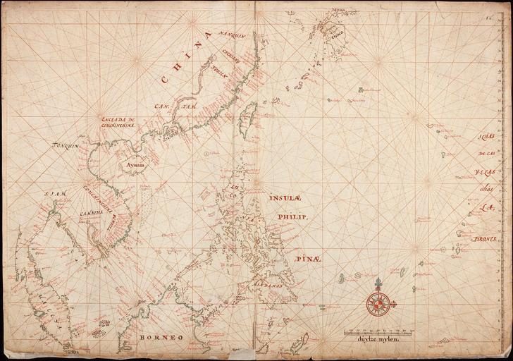
| Keywords: AMH-5181-NA Map of southeast Asia.jpg Artwork nl Kaart van Zuidoost-Azië nl Titel in catalogus Leupe Nationaal Archief Kaart als voren hiermee wordt bedoeld de titel van VEL0288 Kaart van de Chineesche Zee en Kust van Straat Drioens tot Nanquin en de eilanden van Borneo tot Japan en de Ladrones Rechtsboven genummerd 1 b De kompaslijnen zijn gedrukt Toeschrijving en datering volgens catalogus Leupe en Title in the Leupe catalogue National Archives Kaart als voren 'Map as before' referring to the title of VEL0288 Kaart van de Chineesche Zee en Kust van Straat Drioens tot Nanquin en de eilanden van Borneo tot Japan en de Ladrones Numbered top right 1 b The compass lines have been printed Attribution and dating taken from the Leupe catalogue Atlas of Mutual Heritage na http //www atlasofmutualheritage nl/en/object/ id 5181 Source at the Atlas of Mutual Heritage - http //www gahetna nl/collectie/archief/inventaris/index/eadid/4 VEL/inventarisnr/290/level/file Source at the Nationaal Archief en Subjects compass / dial chart / map / plan nl Onderwerpen kompas / windroos plattegrond / kaart en Post this image is related to a VOC trading post called http //www atlasofmutualheritage nl/en/post/ id 332 Melaka Inscription - nl circa 1687 Creator Joan Blaeu Jr nl Joan Blaeu Jr landmeter / kaartenmaker en Joan Blaeu Jr land surveyor / mapmaker Institution Nationaal Archief nl ingekleurde gravure op papier en coloured engraving on paper Size cm 52 74 accession number NL-HaNA_4 VEL_290 old number VEL0290 PD-Art-100 Old maps of the Dutch East India Company 1687 | ||||