MAKE A MEME
View Large Image

| View Original: | AMH-8132-KB_Map_in_bird's_eye_prospect_of_the_island_of_Goeree.jpg (2400x1469) | |||
| Download: | Original | Medium | Small | Thumb |
| Courtesy of: | commons.wikimedia.org | More Like This | ||
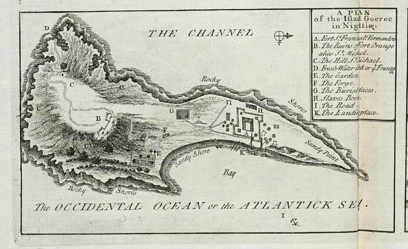
| Keywords: AMH-8132-KB Map in bird's eye prospect of the island of Goeree.jpg Artwork nl Plattegrond in vogelvlucht van het eiland Goeree nl Plattegrond in vogelvlucht van het eiland Goeree A Plan of the Island Goeree in Nigritiae Legenda A-K en Map in bird's eye prospect of the island of Goeree -A Plan of the Island Goeree in Nigritiae Key A-K Atlas of Mutual Heritage kb http //www atlasofmutualheritage nl/en/object/ id 8132 Source at the Atlas of Mutual Heritage en Subjects chart / map / plan bird's-eye view / elevation elevation / bird's-eye view key compass / dial fortification building garden / ornamental garden tanck / well / watering hole anchorage / pier / harbour nl Onderwerpen plattegrond / kaart vogelvlucht / opstand opstand / vogelvlucht legenda kompas / windroos vesting gebouw tuin / siertuin tanck / waterplaats / put rede / haven / pier en Post this image is related to a WIC trading post called http //www atlasofmutualheritage nl/en/post/ id 690 Goeree Island Inscription A Plan of the Island Goeree in Nigritiae nl 1732 Creator Awnsham Churchill Creator John Churchill nl Anoniem / Anonymous graveur / etser Awnsham Churchill uitgever John Churchill uitgever en Anoniem / Anonymous engraver / etcher Awnsham Churchill publisher John Churchill publisher Institution Koninklijke Bibliotheek nl gravure op papier en engraving on paper Size cm 8 5 14 accession number 61 B 25 na p 20 PD-old-auto 1728 Josve05a <span class signature-talk > Maps of the West-Indische Compagnie Gorée 1732 | ||||