MAKE A MEME
View Large Image

| View Original: | AMH-8652-NA_Nineteenth_century_map_of_the_Dutch_possessions_in_South_America,_the_West_Coast_of_Africa_and_New_York.jpg (2400x1748) | |||
| Download: | Original | Medium | Small | Thumb |
| Courtesy of: | commons.wikimedia.org | More Like This | ||
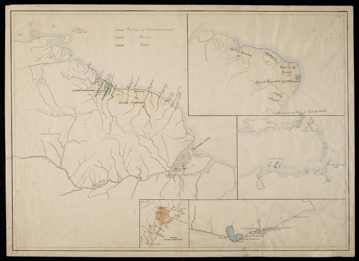
| Keywords: AMH-8652-NA Nineteenth century map of the Dutch possessions in South America, the West Coast of Africa and New York.jpg Artwork nl Negentiende-eeuwse kaart van Nederlandse bezittingen in Zuid Amerika de Westkust van Afrika en New York nl Negentiende-eeuwse historische kaart van Nederlandse bezittingen in Zuid Amerika de Westkust van Afrika en New York Titel in Catalogus Leupe NA Historische schetskaart van a de bezittingen van de W I C de Societeit van Suriname en de Directie van Berbice in Guiana; b de bezittingen der W I C in Brazilië; c de kolonie Nieuw-Nederland; d de koloniën Curaçao St Eustatius en Tabago e de bezittengen op de Kust van Guinea en 19th century historical map of the Dutch possessions in South America the West Coast of Africa and New York Title in the Leupe Catalogue NA Historische schetskaart van a de bezittingen van de W I C de Societeit van Suriname en de Directie van Berbice in Guiana; b de bezittingen der W I C in Brazilië; c de kolonie Nieuw-Nederland; d de koloniën Curaçao St Eustatius en Tabago e de bezittengen op de Kust van Guinea Atlas of Mutual Heritage na http //www atlasofmutualheritage nl/en/object/ id 8652 Source at the Atlas of Mutual Heritage - http //www gahetna nl/collectie/archief/inventaris/index/eadid/4 VELH/inventarisnr/571/level/file Source at the Nationaal Archief en Subjects chart / map / plan nl Onderwerpen plattegrond / kaart nl Anoniem / Anonymous landmeter / kaartenmaker en Anoniem / Anonymous land surveyor / mapmaker Institution Nationaal Archief nl pen en penseel op papier en pen and brush on paper Size cm 52 75 accession number NL-HaNA_4 VELH_571 old number VELH0571 PD-Art-100 Maps of the West-Indische Compagnie | ||||