MAKE A MEME
View Large Image

| View Original: | Atlas_Van_der_Hagen-KW1049B13_003-TVRCICVM_IMPERIVM.jpeg (5500x4396) | |||
| Download: | Original | Medium | Small | Thumb |
| Courtesy of: | commons.wikimedia.org | More Like This | ||
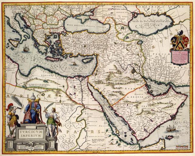
| Keywords: Atlas Van der Hagen-KW1049B13 003-TVRCICVM IMPERIVM.jpeg of the Atlas Van der Hagen in the catalogue of the KB http //opc4 kb nl/DB 1/TTL 1/LNG EN/PPN PPN 353012750 Publishers Creator Joan Blaeu Creator Willem_Janszoon_Blaeu Publishers Creator Joan Blaeu Creator Willem_Janszoon_Blaeu credit line 1635 Deze kaart van het Turkse rijk werd in 1635 gepubliceerd door Willem Jansz Blaeu 1571-1638 en Joan Blaeu 1598-1673 De kaart biedt een goed overzicht van het enorme rijk dat de Turken vanaf de 15e eeuw zowel in Afrika Azië als in Europa hadden veroverd In de tweede helft van de 17de eeuw bereikte het Turkse rijk haar grootste omvang haar grootste omvang ; Rechtsboven een opdracht van Willem Jansz en Joan Blaeu aan David de Wilhem The map of the Turkish Empire was published in 1635 by Willem Jansz Blaeu 1571-1638 and Joan Blaeu 1598-1673 The map provides a good overview of the enormous empire conquered by the Turks from the fifteenth century in Africa Asia and Europe In the second half of the 17th century the Turkish Empire reached its largest size 41 x 52 cm exhibition history Institution Koninklijke Bibliotheek kopergravure Technique copper engraving KW1049B13_003 - Volume 1 Willem Jansz Blaeu - Joan Blaeu Information field Depicted locations Turkish Empire - Asia - Africa - Europe object history object type Kaart Map PD-old-100 place of creation Amsterdam place of discovery Source page at the http //resolver kb nl/resolve urn urn gvn KONB01 350 Geheugen van Nederland / Memory of the Netherlands website Koninklijke Bibliotheek TVRCICVM IMPERIVM Uploaded with GWToolset Atlas Van der Hagen-KW1049B13_003-TVRCICVM IMPERIVM http //resolver kb nl/resolve urn urn gvn KONB01 1049B13_003 size large Atlas van der Hagen | ||||