MAKE A MEME
View Large Image
| View Original: | Atlas_Van_der_Hagen-KW1049B12_013-Accuratissima_PRINCIPATUS_CATALONIAE_et_COMITATUUM_RUSCINONIS_et_CERRETANIAE_DESCRIPTIO.jpeg (5500x4755) | |||
| Download: | Original | Medium | Small | Thumb |
| Courtesy of: | commons.wikimedia.org | More Like This | ||
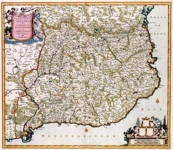
| Keywords: Atlas Van der Hagen-KW1049B12 013-Accuratissima PRINCIPATUS CATALONIAE et COMITATUUM RUSCINONIS et CERRETANIAE DESCRIPTIO.jpeg of the Atlas Van der Hagen in the catalogue of the KB http //opc4 kb nl/DB 1/TTL 1/LNG EN/PPN PPN 353012750 Creator Frederick de Wit Author per F de Wit Publisher Creator Frederick de Wit Author per F de Wit Publisher Creator Frederick de Wit credit line na 1688 De kaart werd in aan het einde van de 17de eeuw uitgegeven door Frederik de Wit 1630-1706 De Wit kopieerde deze kaart naar een voorbeeld van Willem Jansz Blaeu 1571-1638 uit 1635 Blaeu op zijn beurt bediende zich van oorspronkelijk kaartmateriaal van de Portugese kartograaf Joao Baptista Lavanha 1582-1624 The map of Catalonia was published at the end of the 17th century by Frederik de Wit 1630-1706 De Wit copied the map after an example by Willem Jansz Blaeu 1571-1638 from 1635 Blaeu for his part used the original maps from the Portugese cartographer Joao Baptista Lavanha 1582-1624 49 x 56 cm exhibition history Institution Koninklijke Bibliotheek kopergravure Technique copper engraving KW1049B12_013 - Volume 1 Frederik de Wit - Willem Jansz Blaeu - Lavanha Joao Baptista Information field Depicted locations Catalonia - Spain object history object type Kaart Map PD-old-100 place of creation Amsterdam place of discovery Source page at the http //resolver kb nl/resolve urn urn gvn KONB01 251 Geheugen van Nederland / Memory of the Netherlands website Koninklijke Bibliotheek Accuratissima PRINCIPATUS CATALONIAE et COMITATUUM RUSCINONIS et CERRETANIAE DESCRIPTIO Uploaded with GWToolset Atlas Van der Hagen-KW1049B12_013-Accuratissima PRINCIPATUS CATALONIAE et COMITATUUM RUSCINONIS et CERRETANIAE DESCRIPTIO http //resolver kb nl/resolve urn urn gvn KONB01 1049B12_013 size large Atlas van der Hagen | ||||