MAKE A MEME
View Large Image

| View Original: | Atlas_Van_der_Hagen-KW1049B11_046-LORNA,_KNAPDALIA,_CANTIRE,_IURA,_ILA,_GLOTA,_et_BUTHE_INSULAE.jpeg (5500x4586) | |||
| Download: | Original | Medium | Small | Thumb |
| Courtesy of: | commons.wikimedia.org | More Like This | ||
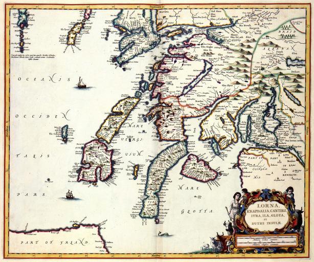
| Keywords: Atlas Van der Hagen-KW1049B11 046-LORNA, KNAPDALIA, CANTIRE, IURA, ILA, GLOTA, et BUTHE INSULAE.jpeg of the Atlas Van der Hagen in the catalogue of the KB http //opc4 kb nl/DB 1/TTL 1/LNG EN/PPN PPN 353012750 Publisher Creator Joan Blaeu Publisher Creator Joan Blaeu credit line 1654 Deze kaart van de Schotse provincie Lorna werd in 1654 door Joan Blaeu 1598-1673 gepubliceerd in zijn atlas van Schotland Hoewel voor de samenstelling van de kaart gebruik werd gemaakt van nauwkeurige beschrijvingen die in opdracht van de Schotse regering aan de redacteur Robert Gordon of Straloch 1580-1661 ter beschikking waren gesteld werd het deze kaart vermoedelijk rechtstreeks gekopieerd van een manuscript van de Schotse kartograaf Timothy Pont ca 1560-1614 uit het begin van de 17de eeuw s commissioned by the Scottish Government and produced by Robert Gordon of Straloch 1580-1661 formed the basis of the atlas most images were directly copied from a manuscript by the Scottish cartographer Timothy Pont c 1560-1614 This map was probable copied from Pont 44 x 54 cm exhibition history Institution Koninklijke Bibliotheek kopergravure Technique copper engraving KW1049B11_046 - Volume 1 Timothy Pont - Robert Gordon of Straloch - Joan Blaeu Information field Depicted locations Scotland - Lorna object history object type Kaart Map PD-old-100 place of creation Amsterdam place of discovery Source page at the http //resolver kb nl/resolve urn urn gvn KONB01 164 Geheugen van Nederland / Memory of the Netherlands website Koninklijke Bibliotheek LORNA KNAPDALIA CANTIRE IURA ILA GLOTA et BUTHE INSULAE Uploaded with GWToolset Atlas Van der Hagen-KW1049B11_046-LORNA KNAPDALIA CANTIRE IURA ILA GLOTA et BUTHE INSULAE http //resolver kb nl/resolve urn urn gvn KONB01 1049B11_046 size large Atlas van der Hagen | ||||