MAKE A MEME
View Large Image

| View Original: | Atlas_Van_der_Hagen-KW1049B13_033-IMPERII_SINARVM_NOVA_DESCRIPTO.jpeg (5500x4292) | |||
| Download: | Original | Medium | Small | Thumb |
| Courtesy of: | commons.wikimedia.org | More Like This | ||
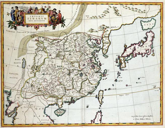
| Keywords: Atlas Van der Hagen-KW1049B13 033-IMPERII SINARVM NOVA DESCRIPTO.jpeg of the Atlas Van der Hagen in the catalogue of the KB http //opc4 kb nl/DB 1/TTL 1/LNG EN/PPN PPN 353012750 Creator Martino_Martini Author Martino Martini Publisher Creator Joan Blaeu Author Martino Martini Publisher Creator Joan Blaeu credit line 1655 In 1655 publiceerde Joan Blaeu 1598-1673 een atlas van China samengesteld door de Italiaanse jezuiet Martino Martini 1614-1661 Deze overzichtskaart van het Chineese rijk vormde de eerste kaart uit de atlas Hierop zien we de gebieden die in de atlas in gedetailleerde kaarten verder worden uitgewerkt de vijftien Chinese provincies alsmede Japan en Korea The general map was produced at about the time when the Ming dynasty was toppled and the country came under Manchu control The provinces of modern China retain most of their 17th century divisions and a comparison between Martinis picture and the modern outlines shows impressive similarities highlighting the quality of the oriental maps Martini must have copied He also removed remaining doubts about the the peninsularity of Korea and offers here his new and influential outline for Japan 46 x 60 cm exhibition history Institution Koninklijke Bibliotheek kopergravure Technique copper engraving KW1049B13_033 - Volume 1 Joan Blaeu - Martino Martini Information field Depicted locations China - Japan - Korea object history object type Kaart Map PD-old-100 place of creation Amsterdam place of discovery Source page at the http //resolver kb nl/resolve urn urn gvn KONB01 380 Geheugen van Nederland / Memory of the Netherlands website Koninklijke Bibliotheek IMPERII SINARVM NOVA DESCRIPTO Uploaded with GWToolset Atlas Van der Hagen-KW1049B13_033-IMPERII SINARVM NOVA DESCRIPTO http //resolver kb nl/resolve urn urn gvn KONB01 1049B13_033 size large Atlas van der Hagen | ||||