MAKE A MEME
View Large Image

| View Original: | Barry_Point_Fire_map,_Oregon_and_California,_2012.jpg (2851x3610) | |||
| Download: | Original | Medium | Small | Thumb |
| Courtesy of: | commons.wikimedia.org | More Like This | ||
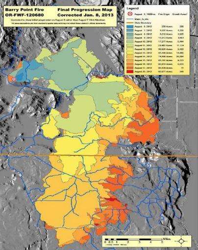
| Keywords: Barry Point Fire map, Oregon and California, 2012.jpg en Fire progress map for the Barry Point Fire a large wildfire that burned forest land in south central Oregon and northeastern California in 2012 2012-01-08 http //www fs usda gov/Internet/FSE_DOCUMENTS/stelprdb5424730 pdf United States Forest Service other versions PD-USGov Uploaded with UploadWizard Fremont-Winema National Forest Modoc National Forest Wildfires | ||||