MAKE A MEME
View Large Image

| View Original: | Bowstring sf.jpg (900x600) | |||
| Download: | Original | Medium | Small | Thumb |
| Courtesy of: | commons.wikimedia.org | More Like This | ||
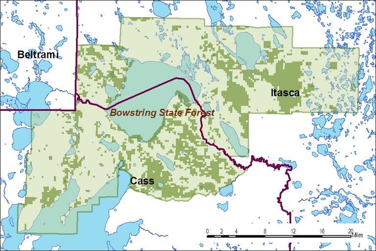
| Keywords: Bowstring sf.jpg Map of Bowstring State Forest showing boundary and state forest lands dark green 2010-12-12 Transferred from http //en wikipedia org en wikipedia by SreeBot Minn-rox at en wikipedia other versions Minn-rox Original upload log page en wikipedia Bowstring_sf jpg Upload date User Bytes Dimensions Comment 2010-12-13 14 52 UTC Minn-rox 453831 bytes 900×600 <small><nowiki>Reverted to version as of 14 48 13 December 2010</nowiki></small> 2010-12-13 14 50 UTC Minn-rox 453831 bytes 900×600 <small><nowiki>Reverted to version as of 14 46 13 December 2010</nowiki></small> 2010-12-13 14 48 UTC Minn-rox 453831 bytes 900×600 <small><nowiki> </nowiki></small> 2010-12-13 14 46 UTC Minn-rox 453831 bytes 900×600 <small><nowiki>Added information on property ownership </nowiki></small> 2010-12-12 19 39 UTC Minn-rox 382120 bytes 900×600 <small><nowiki>Map of Bowstring State Forest boundaries</nowiki></small> Protected areas of Minnesota 1927 establishments 1963 establishments Cass County Minnesota Itasca County Minnesota | ||||