MAKE A MEME
View Large Image

| View Original: | Brecknock town plan 4669580.jpg (2101x2314) | |||
| Download: | Original | Medium | Small | Thumb |
| Courtesy of: | commons.wikimedia.org | More Like This | ||
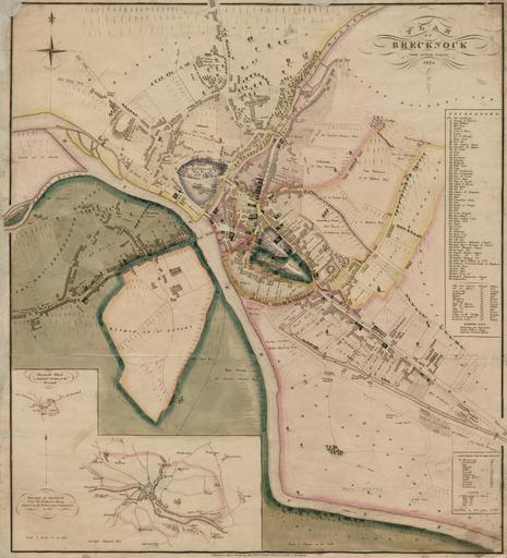
| Keywords: Brecknock town plan 4669580.jpg Brecon ôs wards and parishes are clearly identified together with a long vanished race course between the Monmouthshire and Brecon Canal and the River Usk The inset map bottom left of the Borough of Brecon with the detached ward of Trecastle is based on R K Dawson ôs Ordnance Survey map of 1832 Of the Welsh town plans only on the Brecon plan is Wood described as of Caernarvon which possibly implies that he was resident there whilst preparing his Welsh plans 4669580 1834 John Wood c 1780 - 1847 PD-old Brecon John Wood maps of Wales Images uploaded as part of NLW - WMUK collaboration | ||||