MAKE A MEME
View Large Image
| View Original: | Carte_de_Saint-Christophe_Sanson_1650.png (3207x2358) | |||
| Download: | Original | Medium | Small | Thumb |
| Courtesy of: | commons.wikimedia.org | More Like This | ||
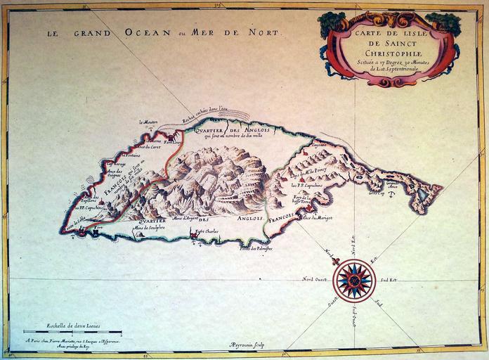
| Keywords: Carte de Saint-Christophe Sanson 1650.png fr Carte de l'île de Saint-Christophe avec les quartiers français et anglais dressée par Nicolas Sanson en 1650 2014-06-28 18 36 54 Scan of old map Sanson Custom license marker 2014 06 28 PD-old-70 Uploaded with UploadWizard Old maps of Saint Kitts and Nevis Maps made in the 17th century Maps by Nicolas Sanson | ||||