MAKE A MEME
View Large Image

| View Original: | Ctrnh.jpg (1275x1650) | |||
| Download: | Original | Medium | Small | Thumb |
| Courtesy of: | commons.wikimedia.org | More Like This | ||
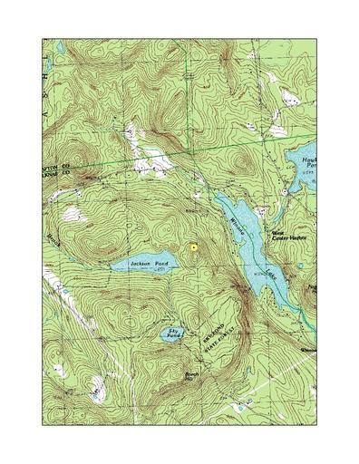
| Keywords: Ctrnh.jpg en wikipedia 2012 January 8 New Hampshire located in the eastern portion of the town of New Hampton Geographic center calculated using ArcInfo on the outline of New Hampshire Topo backdrop is the U S Geological Survey Holderness NH 7-1/2 minute quadrangle dated 1987 2006-11-7 Own <br />Transferred from http //en wikipedia org en wikipedia Ken Gallager at http //en wikipedia org en wikipedia en wikipedia Ken Gallager Original upload log page en wikipedia Ctrnh jpg 2006-11-07 15 07 Ken Gallager 1275×1650 2202763 bytes <nowiki>Yellow dot shows the geographic center of New Hampshire located in the eastern portion of the town of New Hampton Geographic center calculated using ArcInfo on the outline of New Hampshire Topo backdrop is the U S</nowiki> Maps of New Hampshire | ||||