MAKE A MEME
View Large Image

| View Original: | Edgeøya labelled.png (503x530) | |||
| Download: | Original | Medium | Small | Thumb |
| Courtesy of: | commons.wikimedia.org | More Like This | ||
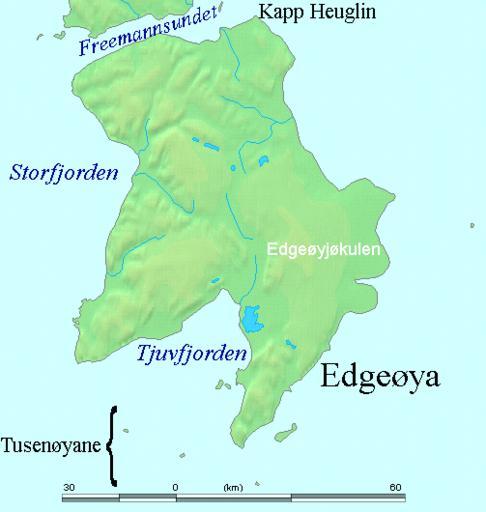
| Keywords: Edgeøya labelled.png en Map detailing the marine features of Edgeøya in the Svalbard archipelago Locations were labelled mainly based on detailed maps from http //www svalbard-images com/spitsbergen/edgeoya-e php svalbard-images com cross-referenced with other map sources where possible http //miljo npolar no/placenames/pages/detaile asp placeNameID 615073M Norwegian Polar Institute data was also used 2006-07-29 own assumed TheGrappler http //www demis nl/home/pages/wms/demiswms htm DEMIS World Map Server generated this map from Public Domain sources DEMIS does not claim any rights over the resultant image http //www2 demis nl/mapserver/DataSrc htm Alterations including the addition of settlements and captions were performed on 24 July 2006 by User TheGrappler the uploader who releases all associated rights PD-Demis Maps of Svalbard Edgeøya Storfjorden Svalbard | ||||