MAKE A MEME
View Large Image

| View Original: | Elgin-Ohare-Expwy-map.png (960x569) | |||
| Download: | Original | Medium | Small | Thumb |
| Courtesy of: | commons.wikimedia.org | More Like This | ||
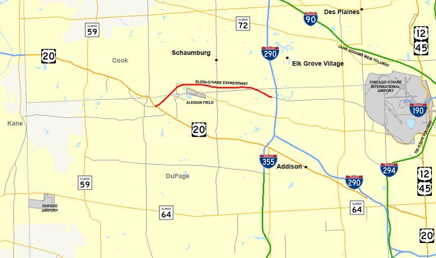
| Keywords: Elgin-Ohare-Expwy-map.png Elgin-O'Hare Expressway Own work - using Quantum GIS 0 10 0 based on data collected from http //www census gov/geo/www/cob/co2000 html the Census Bureau borders water urban areas and http //www fhwa dot gov/planning/nhpn/ the Federal Highway Administration the roads User Master son 2009-02-01 boilerplate id pd style width 95 ; margin 0 auto; text-align justify; background F1F1DE; padding 0 10px; border 1px solid CC9; I Master son the creator of this image hereby release it into the public domain If that cannot be done for any reason including the nonexistence of a way to release a work into the public domain I release it or my changes in the case of a derivative work under the following license 8 cellpadding 0 style clear both;width 80 ;margin 0 5em auto;background-color f9f9f9;border 2px solid e0e0e0 - 64px Copyleft Copyleft this work of art is free you can redistribute it and/or modify it according to terms of the Free Art License <br />You will find a specimen of this license on the site Copyleft Attitude http //artlibre org/licence/lal/en/ as well as on other sites Copyrighted-Layout - 64px The copyright holder of this image allows anyone to use it for any purpose including unrestricted redistribution commercial use and modification Maps of Cook County Illinois Maps of DuPage County Illinois Illinois Route 390 Road maps of Illinois | ||||