MAKE A MEME
View Large Image

| View Original: | India_Bangladesh_border_US_Army_Map_Service.jpg (680x788) | |||
| Download: | Original | Medium | Small | Thumb |
| Courtesy of: | commons.wikimedia.org | More Like This | ||
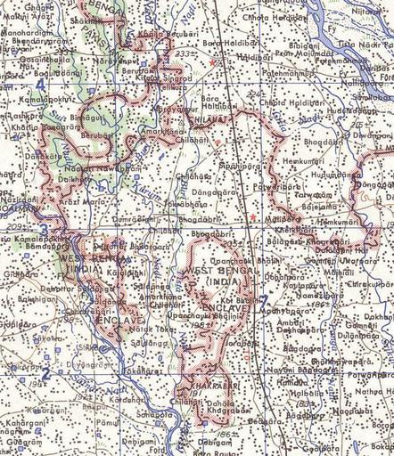
| Keywords: India Bangladesh border US Army Map Service.jpg Map of the India-Bangladesh border US army map service 1960s Shows some of the enclaves on the border but is simplified due to the tiny size of many of them Located in area near 26 15 43 N 88 45 6 E There are many smaller enclaves in this area see http //geosite jankrogh com/enklaver/CoochBehar_Annotated jpg external link for a more detailed map Note Bangladesh is shown as 'East Pakistan' PD-USGov txu-oclc-6614190-ng45-8 jpg ams/india/ üCategory International borders of India Bangladesh maps by U S Army Map Service Relations of Bangladesh and India India maps by U S Army Map Service Exclaves and enclaves | ||||