MAKE A MEME
View Large Image

| View Original: | Ireland900.png (2060x2630) | |||
| Download: | Original | Medium | Small | Thumb |
| Courtesy of: | commons.wikimedia.org | More Like This | ||
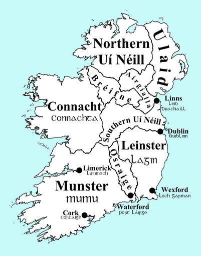
| Keywords: Ireland900.png en Map of Ireland circa 900 with overkingdoms and principal Viking towns indicated pt Mapa de Irlanda perto do ano 900 ilustrando os reinos e principais cidades da época own Erakis 2010-07-31 Ireland900 svg Maps of the history of Ireland | ||||