MAKE A MEME
View Large Image
| View Original: | ItalianMareNostrum.jpg (1254x630) | |||
| Download: | Original | Medium | Small | Thumb |
| Courtesy of: | commons.wikimedia.org | More Like This | ||
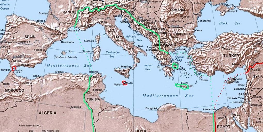
| Keywords: ItalianMareNostrum.jpg Map of Italian Mare Nostrum Italian Mediterranean showing inside the green line dots the italian areas in the Mediterranean sea during summer 1942 in red those under British control The remaining areas were under Axis control Germany Bulgary and Vichy France and under friendly neutrality Spain Turkey self-made I have based my work on the original Commons Image Mediterranean Relief jpg licensed PD-USGov 2007-08 Brunodambrosio File GreaterItalia jpg<br/> File ProgettoImperoItaliano jpg Fact disputed History of Italy Colonialism of Italy Maps of the Mediterranean Basin | ||||