MAKE A MEME
View Large Image

| View Original: | Jua TopoMap.png (654x531) | |||
| Download: | Original | Medium | Small | Thumb |
| Courtesy of: | commons.wikimedia.org | More Like This | ||
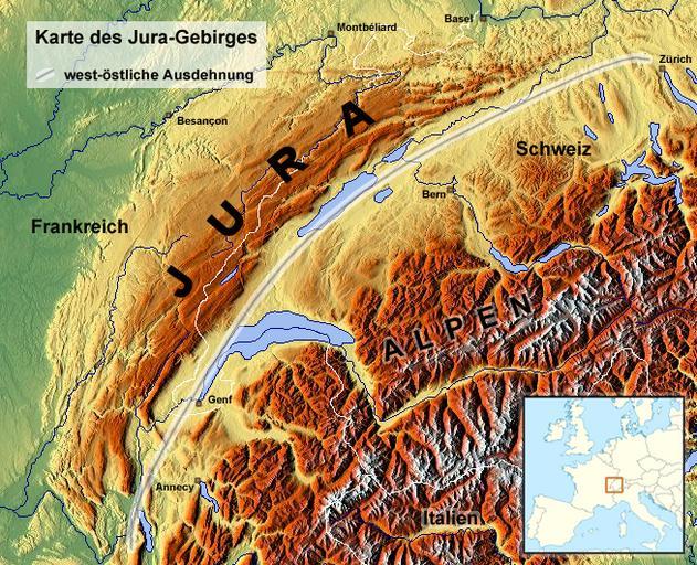
| Keywords: Jua TopoMap.png de Reliefkarte des schweizerisch-französischen Jura-Gebirges en Topographic map of Jura mountains in Switzerland and France Schweiz-Französischer-Jura png 50 2012-10-31 07 12 UTC Schweiz-Französischer-Jura png Hans Braxmeier derivative work Albinfo <gallery>Jura TopoMap png</gallery> albinfo Schweiz-Französischer-Jura png Cc-zero Original upload log This image is a derivative work of the following images File Schweiz-Französischer-Jura png licensed with Cc-zero 2011-01-31T13 59 08Z Hans Braxmeier 888x546 1176640 Bytes <nowiki> de Reliefkarte des Schweiz-Französischen-Juras own User Hans Braxmeier Hans Braxmeier 31 01 2011 other_versio</nowiki> Uploaded with derivativeFX Maps of Jura mountains | ||||