MAKE A MEME
View Large Image

| View Original: | LDRhosCymydau.png (1174x866) | |||
| Download: | Original | Medium | Small | Thumb |
| Courtesy of: | commons.wikimedia.org | More Like This | ||
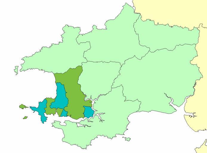
| Keywords: LDRhosCymydau.png A map of the cantref of Rhos identical to the later hundred of Roose shown in relation to ancient Dyfed and showing the Norman Lordships into which it was divided Haverfordwest Hwlffordd in green and Walwyn's Castle Castell Gwalchmei in blue Transferred from http //en wikipedia org en wikipedia; transferred to Commons by User Kafuffle using http //tools wikimedia de/~magnus/commonshelper php CommonsHelper 2007-10-01 Original uploader was LinguisticDemographer at http //en wikipedia org en wikipedia Released into the public domain by the author en wikipedia LinguisticDemographer Original upload log page en wikipedia LDRhosCymydau png 2007-10-01 22 02 LinguisticDemographer 1 174 × 866 43214 bytes <nowiki>A map of the cantref of Rhos identical to the later hundred of Roose shown in relation to ancient Dyfed and showing the Norman Lordships into which it was divided Haverfordwest Hwlffordd in blue and Walwyn's Castle Castell Gwalchmei in gre</nowiki> Maps of former subdivisions of Wales Medieval Wales History of Pembrokeshire Haverfordwest | ||||