MAKE A MEME
View Large Image

| View Original: | LichterfeldeAufDroschkenwegweiser_1884.png (3460x3390) | |||
| Download: | Original | Medium | Small | Thumb |
| Courtesy of: | commons.wikimedia.org | More Like This | ||
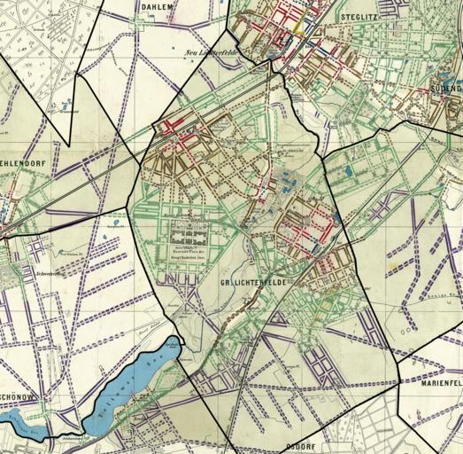
| Keywords: LichterfeldeAufDroschkenwegweiser 1884.png Die Landgemeinde Lichterfelde südlich von Berlin und deren Straße einschließlich Gemeindegrenzen 1884 auf Basis der Map for calculating the value of ground and floor in the southwest suburbs of Berlin Scanned by the Zentral- und Landesbibliothek Berlin ZLB use under Public Domain allowedMap for calculating the value of ground and floor in the southwest suburbs of Berlin Scanned by the Zentral- und Landesbibliothek Berlin ZLB use under Public Domain allowed ZLB-Berliner_Ansichten-Juni jpg 50 2012-06-29 12 10 UTC ZLB-Berliner_Ansichten-Juni jpg user Christian Günther derivative work Boonekamp Originalkarte auf Lichterfelde beschnitten und Grenzen verstärkt Boonekamp ZLB-Berliner_Ansichten-Juni jpg Original upload log This image is a derivative work of the following images File ZLB-Berliner_Ansichten-Juni jpg licensed with PD-old 2005-01-21T18 00 56Z Christian Günther 4961x3390 5673432 Bytes <nowiki></nowiki> Uploaded with derivativeFX Die Landgemeinde Lichterfelde südlich von Berlin und deren Straßen 1892 einschließlich Gemeindegrenzen 1884 auf Basis der Map for calculating the value of ground and floor in the southwest suburbs of Berlin Scanned by the Zentral- und Landesbibliothek Berlin ZLB use under Public Domain allowedMap for calculating the value of ground and floor in the southwest suburbs of Berlin Scanned by the Zentral- und Landesbibliothek Berlin ZLB use under Public Domain allowed ZLB-Berliner_Ansichten-Juni jpg 50 2012-06-29 12 10 UTC ZLB-Berliner_Ansichten-Juni jpg user Christian Günther derivative work Boonekamp auf Lichterfelde verkleinert und Gemeindegrenzen verstärkt Boonekamp ZLB-Berliner_Ansichten-Juni jpg PD-old Original upload log This image is a derivative work of the following images File ZLB-Berliner_Ansichten-Juni jpg licensed with PD-old 2005-01-21T18 00 56Z Christian Günther 4961x3390 5673432 Bytes <nowiki></nowiki> Uploaded with derivativeFX Parts of old maps of Berlin Maps of Berlin-Lichterfelde | ||||