MAKE A MEME
View Large Image
| View Original: | Lockwood_and_Meltham_Turnpike_of_1818.png (3455x4096) | |||
| Download: | Original | Medium | Small | Thumb |
| Courtesy of: | www.flickr.com | More Like This | ||
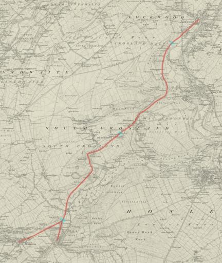
| Keywords: maps The route of the Lockwood and Meltham Turnpike of 1818 marked in red on the 1854 OS map of the area. The three toll points (Dungeon, Netherton and Harewood) are highlighted in blue. The original map is courtesy of the National Library of Scotland. The route of the Lockwood and Meltham Turnpike of 1818 marked in red on the 1854 OS map of the area. The three toll points (Dungeon, Netherton and Harewood) are highlighted in blue. The original map is courtesy of the National Library of Scotland. | ||||