MAKE A MEME
View Large Image

| View Original: | Map of Dingley Freeway.png (1194x803) | |||
| Download: | Original | Medium | Small | Thumb |
| Courtesy of: | commons.wikimedia.org | More Like This | ||
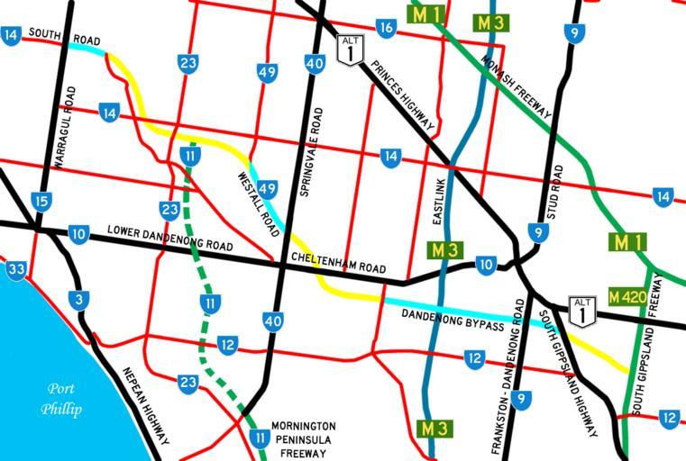
| Keywords: Map of Dingley Freeway.png A map of the Dingley Freeway route which shows the intended route and sections of the freeway which have been constructed 2007-12-12 - Black Road Major road or highway - <font color green >Green Road</font> Freeway - <font color 006699 >Blue Road</font> Tollway - <font color red >Red Road</font> Minor road - Dotted road Road is either proposed to be built or under construction - black <font color 00FFFF >Fluro Blue Road Constructed sections of the Dingley Freeway - black <font color FFFF00 >Bright Yellow Road Proposed sections of the Dingley Freeway - 50px Australian Alphanumeric State Route shield - 30px Australian State Route shield - 30px Australian National Route shield en wikipedia Lakeyboy Original upload log page en wikipedia Map_of_Dingley_Freeway png 2007-12-12 01 14 Lakeyboy 1194×803 1284188 bytes <nowiki>A map of the Dingley Freeway route which shows the intended route and sections of the freeway which have been constructed Created by myself Can be used for any purpose for any reason </nowiki> 2007-12-12 01 33 Lakeyboy 1194×803 265395 bytes <nowiki></nowiki> 2007-12-12 01 53 Lakeyboy 1194×803 282260 bytes <nowiki> Summary A map of the Dingley Freeway route which shows the intended route and sections of the freeway which have been constructed Created by myself Can be used for any purpose for any reason Licensing </nowiki> 2007-12-12 01 59 Lakeyboy 1194×803 282337 bytes <nowiki> Summary A map of the Dingley Freeway route which shows the intended route and sections of the freeway which have been constructed Created by myself Can be used for any purpose for any reason Licensing - Black Road Major road or highway - <font color green >Green Road</font> Freeway - <font color 006699 >Blue Road</font> Tollway - <font color red >Red Roa</nowiki> Freeways in Victoria | ||||