MAKE A MEME
View Large Image

| View Original: | MDOT Constantine Bypass-2.png (2550x1801) | |||
| Download: | Original | Medium | Small | Thumb |
| Courtesy of: | commons.wikimedia.org | More Like This | ||
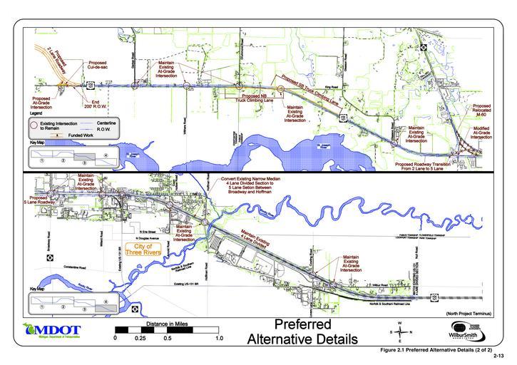
| Keywords: MDOT Constantine Bypass-2.png Planning maps of the proposed bypass of Constantine Michigan along U S Route 131 These are panels 3 and 4 of a 4-panel set illustrating the location of the proposed road and changes to other roadways Note North is to the right Figure 2 1 Shot 2 from the http //www michigan gov/mdot/0 1607 7-151-9621_11058_53088_53107-192114-- 00 html US-131 Final Environmental Impact Statement and Section 4 f Evaluation 2008-02-28 Michigan Department of Transportation 2011020210006242 Retouched picture Converted to PNG Imzadi1979 http //www michigan gov/documents/mdot/MDOT_US131_Improvement_Study_FEIS_Figure_2 1_Sht02_234715_7 pdf Michigan Department of Transportation U S Route 131 | ||||