MAKE A MEME
View Large Image

| View Original: | Odessa_Impact_Crater_Topographic_Map.jpg (2292x2298) | |||
| Download: | Original | Medium | Small | Thumb |
| Courtesy of: | commons.wikimedia.org | More Like This | ||
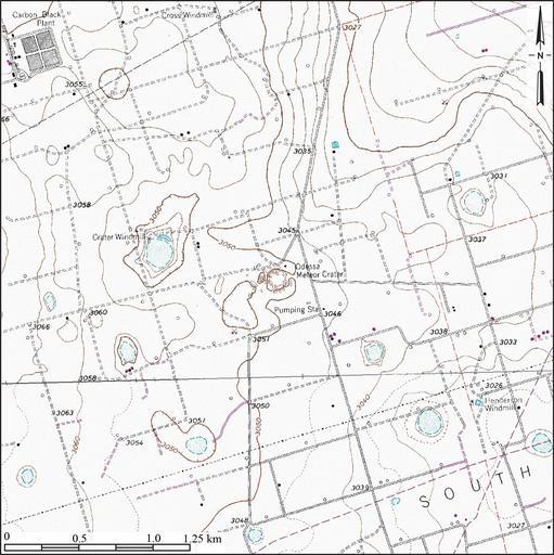
| Keywords: Odessa Impact Crater Topographic Map.jpg en Topographic map of Odessa Meteor Crater in the southwestern part of Ector County southwest of the city of Odessa Texas The prominent but shallow depressions which are occupied by playa lakes in the area surrounding extraterrestrial impact crater are of terrestrial nonimpact origin Constructed from county topographic map DRG mosaic for Ector County Texas from USDA/NRCS - National Cartography Geospatial Center using Global Mapper 12 0 and Adobe Illustrator Contour interval 5 feet Latitude 31° 45' 21 78 N Longitude 102° 28' 44 08 W 2011-07-03 USDA/FSA Aerial Photography Field Office United States Geological Survey PD-USGov Uploaded with UploadWizard Odessa Meteor Crater | ||||