MAKE A MEME
View Large Image

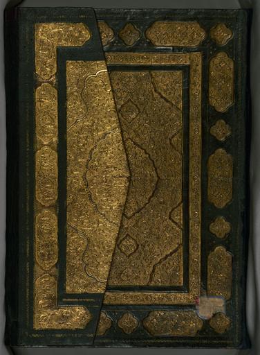
| View Original: | Piri Reis - Book on Navigation - Walters W658 - Closed Top View A.jpg (1320x1799) | |||
| Download: | Original | Medium | Small | Thumb |
| Courtesy of: | commons.wikimedia.org | More Like This | ||
| Keywords: Piri Reis - Book on Navigation - Walters W658 - Closed Top View A.jpg Islamic - Binding from Book on Navigation - Walters W658binding - Top Interior jpg rtl Walters Art Museum artwork of the coastline of Anatolia and the islands of the Aegean Sea the Peloponnese peninsula and the eastern and western coasts of the Adriatic Sea It then proceeds to describe the western shores of Italy southern France Spain North Africa Palestine Israel Lebanon Syria western Anatolia various islands north of Crete the Sea of Marmara Bosporus and the Black Sea It ends with a map of the shores of the Caspian Sea fol 374a late 11th century AH/AD 17th century-early 12th century AH/AD 18th century Ottoman ink and pigments on laid European paper bound between boards covered with red leather with gold Folio cm 34 24 ; H open in cradle 14 1/8 x W 25 13/16 x D 5 13/16 in 35 8 x 65 5 x 14 7 cm accession number W 658 19195 Ahmad Afandi date and mode of acquisition unknown see folio 4a Ali Afandi date and mode of acquisiton unknown see folio 4a Sayyid Ali Qapudan date and mode of acquisition unknown see folio 1a Sultan Mahmud Khan date and mode of acquistion unknown waqf seal and followed by a bequest statement now erased and the seal of the inspector of wakfs Mustafá Tahir see folio 4a Henry Walters Baltimore date and mode of acquisition unknown Walters Art Museum Henry Walters Acquired by Henry Walters Expanding World Views A Millennium of Maps The Walters Art Museum Baltimore 2001-2002 Maps Finding Our Place in the World The Field Museum Chicago; The Walters Art Museum Baltimore 2007-2008 Poetry and Prayer Islamic Manuscripts from the Walters Art Museum The Walters Art Museum Baltimore 2010 place of origin Turkey Walters Art Museum license 3D Piri Reis Kitab-ı Bahriye Walters MS 658 000A Media contributed by the Walters Art Museum needs category review | ||||