MAKE A MEME
View Large Image

| View Original: | Pozega pakrac 1606 en.png (720x431) | |||
| Download: | Original | Medium | Small | Thumb |
| Courtesy of: | commons.wikimedia.org | More Like This | ||
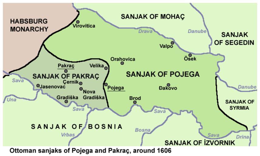
| Keywords: Pozega pakrac 1606 en.png en Ottoman sanjaks of Pojega PoĹľega and Pakraç Pakrac around 1606 hr Osmanski sandĹľaci PoĹľega i Pakrac oko 1606 own PANONIAN 2013 Cc-zero References Istorijski atlas Geokarta Beograd 1999 Istorijski atlas Intersistem kartografija Beograd 2010 Ĺ kolski istorijski atlas Zavod za izdavanje udĹľbenika SR Srbije Beograd 1970 Povijesni atlas UÄŤila - Zagreb Zagreb 1971 Petrit Imami Srbi i Albanci kroz vekove Beograd 2000 http //www dodaj rs/f/3F/kt/4Ntqoy7w/046kartabosanskogpasalu jpg http //www camo ch/Images/Bosanskipasaluk gif http //img810 imageshack us/img810/7240/1606bosanskipasaluk jpg http //www camo ch/Images3/bhpasaluk jpg http //www sandzakvijesti net/wp-content/uploads/2013/11/kartabosanskogpasalu jpg http //edukat org/TN/images/stories/Edukat/Obrazovanje/bosanski 20paaluk 2017 20vijek 20370 jpg http //forum net hr/cfs-filesystemfile ashx/__key/CommunityServer Discussions Components Files/14/6825 bosna1606god png http //img23 imageshack us/img23/5476/15931606bosanskipasaluk jpg Maps of the history of Croatia 1526 “1918 Maps of the history of Slavonia Maps of sanjaks of the Ottoman Empire Maps of the Ottoman Empire in the 17th-century | ||||