MAKE A MEME
View Large Image

| View Original: | REVILLAGIGEDO_CHANNEL_NOAA_17434-11-1989.jpg (13637x17606) | |||
| Download: | Original | Medium | Small | Thumb |
| Courtesy of: | commons.wikimedia.org | More Like This | ||
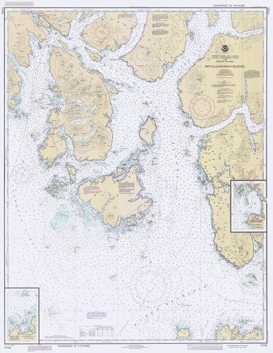
| Keywords: REVILLAGIGEDO CHANNEL NOAA 17434-11-1989.jpg LargeImage en REVILLAGIGEDO CHANNEL Annette Island Duke Island and the southern opening of Behm Canal Chart from 1989 obsolete for navigation Ketchikan is in the upper left corner Annette Island is the largest whole island shown in upper left center and Metlakatla is roughly half-way down its western side Nichols Passage lies west and north of Annette Island and Felice Strait lies between Annette Island and Duke Island to the south and Mary Island to the east 1989 NOAA Office of Coast Survey http //historicalcharts noaa gov/historicals/preview/image/17434-2-1981 Office of Coast Survey PD-USGov Uploaded with UploadWizard Maps of Alaska Revillagigedo Channel Geography of Metlakatla Alaska Nautical charts Straits of Alaska 1989 maps Maps of fjords | ||||