MAKE A MEME
View Large Image

| View Original: | Roman Empire with praetorian prefectures in 400 AD.png (2052x1414) | |||
| Download: | Original | Medium | Small | Thumb |
| Courtesy of: | commons.wikimedia.org | More Like This | ||
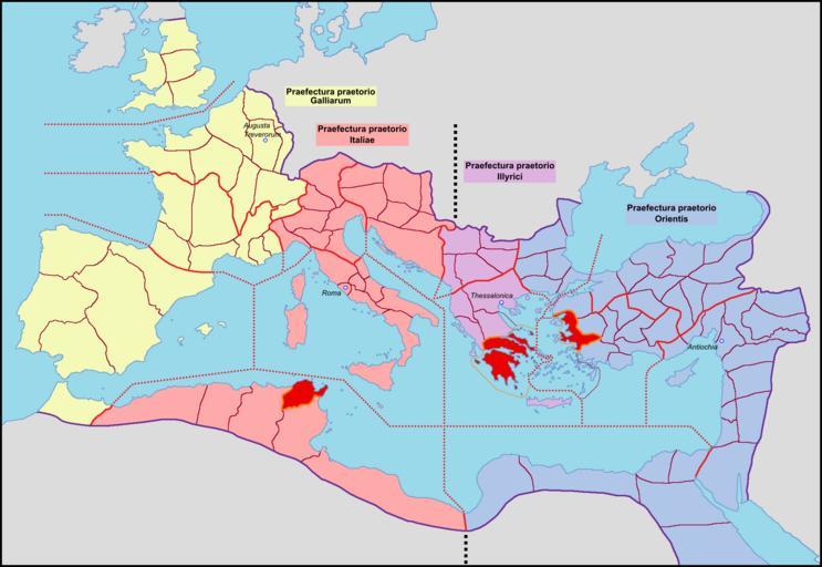
| Keywords: Roman Empire with praetorian prefectures in 400 AD.png en Map of the Roman Empire in praetorian prefectures in AD 400 with an unlikely treatment of the British provinces fr Carte de l'Empire romain avec ses préfectures du prétoire en 400 après J -C own Mandrak 04/03/09 Blank map File Blank Roman Empire png Maps of Roman provinces Praetorian prefectures Notitia Dignitatum ImageNote 1 333 67 190 205 2052 1414 2 Highly unlikely provincial arrangement Britannia I probably included Wales and Cornwall and the hinterland connecting them Wales is generally considered the least likely of the options for the location of the 4th-century 'province' of Valentia even if it existed as a separate entity ImageNoteEnd 1 | ||||