MAKE A MEME
View Large Image

| View Original: | Sioux_Falls.jpg (3264x2448) | |||
| Download: | Original | Medium | Small | Thumb |
| Courtesy of: | www.flickr.com | More Like This | ||
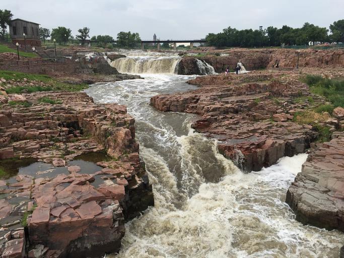
| Keywords: usgs science waterfalls sioux falls siouxfalls south dakota southdakota eros satellite earth landsat landscape outdoor water creek rock rock formation canyon river riverbed stream Sioux Falls — A recent photo of the Big Sioux River, as it passes through the city of Sioux Falls, South Dakota, shows off this amazing waterfall for which the town is named. Also located just north of downtown Sioux Falls is the USGS EROS data center. EROS Center is home to the Landsat program, which annually distributes millions of satellite images of Earth's changing landscape to users worldwide for a myriad of purposes ranging from agricultural and water management to disaster response to scientific and national security uses. You can download the latest Landsat imagery, access data, and more by visiting the EROS site at eros.usgs.gov. Photo credit: Alex Demas, USGS. #USGS #science #waterfalls #SiouxFalls #SouthDakota #EROS #satellite #Earth #Landsat Sioux Falls — A recent photo of the Big Sioux River, as it passes through the city of Sioux Falls, South Dakota, shows off this amazing waterfall for which the town is named. Also located just north of downtown Sioux Falls is the USGS EROS data center. EROS Center is home to the Landsat program, which annually distributes millions of satellite images of Earth's changing landscape to users worldwide for a myriad of purposes ranging from agricultural and water management to disaster response to scientific and national security uses. You can download the latest Landsat imagery, access data, and more by visiting the EROS site at eros.usgs.gov. Photo credit: Alex Demas, USGS. #USGS #science #waterfalls #SiouxFalls #SouthDakota #EROS #satellite #Earth #Landsat | ||||