MAKE A MEME
View Large Image

| View Original: | Sweden 1658.png (465x700) | |||
| Download: | Original | Medium | Small | Thumb |
| Courtesy of: | commons.wikimedia.org | More Like This | ||
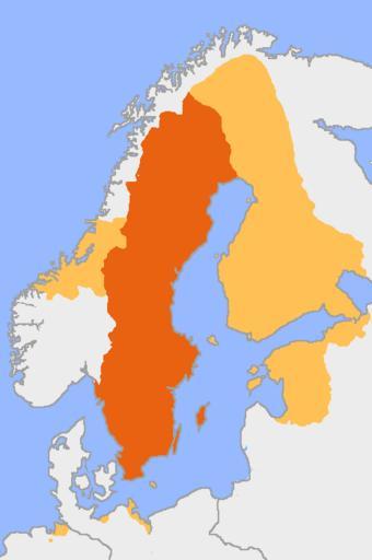
| Keywords: Sweden 1658.png Originally uploaded by en User Salleman to English wikipedia on June 17 2005 Sweden at the height of its territorial expansion following the Treaty of Roskilde in 1658 The yellow colored area is the extension of modern Sweden The map was drawn on free hand following a map in Nationalencyklopedin and the borders should be considered somewhat approximate The map is based on Image Europe plain rivers png Image history of en Image Sweden 1658 png 08 44 17 June 2005 Salleman Talk contribs uploaded Image Sweden 1658 png Sweden on the height of its territorial expansion following the Treaty of Roskilde in 1658 The light orange color is the extension of modern Sweden The map was drawn on free hand following a map in Nationalencyklopedin and the borders en English Wikipedia Salleman Maps of the history of Scandinavia Maps of the Swedish Empire 1561-1721 1658 in Sweden | ||||