MAKE A MEME
View Large Image

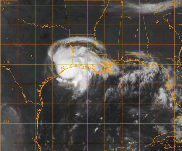
| View Original: | US_Navy_080805-N-0000W-001_A_GOES-12_infrared_satellite_image_provided_by_the_U.S._Naval_Research_Laboratory,_Monterey,_Calif.,_showing_the_status_of_Tropical_Storm_Edouard_at_approximately_4-00_am_EST.jpg (1024x853) | |||
| Download: | Original | Medium | Small | Thumb |
| Courtesy of: | commons.wikimedia.org | More Like This | ||
| Keywords: US Navy 080805-N-0000W-001 A GOES-12 infrared satellite image provided by the U.S. Naval Research Laboratory, Monterey, Calif., showing the status of Tropical Storm Edouard at approximately 4-00 am EST.jpg en GULF OF MEXICO Aug 5 2008 A GOES-12 infrared satellite image provided by the U S Naval Research Laboratory Monterey Calif showing the status of Tropical Storm Edouard at approximately 4 00 am EST Edouard made landfall near Port Arthur Texas as a strong tropical storm with maximum sustained winds near 65 mph and higher gusts It is moving west-northwest at 14 mph The storm is expected to weaken as it continues into Texas U S Navy photo Released 2008-08-05 080805-N-0000W-001 Navy http //www navy mil/view_image asp id 62188 U S Navy photo PD-USGov-Military-Navy Satellite pictures of the Gulf of Mexico Satellite pictures of tropical cyclones GOES 12 pictures | ||||