MAKE A MEME
View Large Image

| View Original: | Views of Brighton - View towards Bear Road-Coombe Road residential area from Hollingbury Fort (August 2013).jpg (4448x1937) | |||
| Download: | Original | Medium | Small | Thumb |
| Courtesy of: | commons.wikimedia.org | More Like This | ||
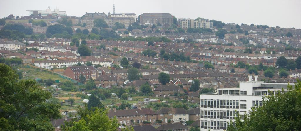
| Keywords: Views of Brighton - View towards Bear Road-Coombe Road residential area from Hollingbury Fort (August 2013).jpg Views of Brighton and Hove 9 This view looks slightly east of due south from near the top of Hollingbury Hill 584 ft m above sea level towards the Bear Road/Coombe Road neighbourhood and beyond Features click to enlarge The allotments separate the Bear Road area from the Bevendean estate To the right of the allotments roads such as Dewe Redvers Buller and Nesbitt Road run left-right towards the steeply sloping parallel Milner and Coombe Roads The treeline going uphill in the centre of the picture runs between Milner and Coombe Roads Above this Elm Grove runs right across the picture from right to left below the large hospital buildings on the skyline The sharply angled streets in the top right are the terraces running between Elm Grove and Hartington Road On the skyline from left to right are Brighton Racecourse; Brighton General Hospital; new flats on Pankhurst Avenue; and the 1920s semi-detached houses of the Pankhurst Estate In the foreground right at the bottom are semi-detached houses on The Highway at the bottom end of the Moulsecoomb estate These face Lewes Road On the other side of Lewes Road the upper storeys of the Cockroft Building are visible This is the main tower block of the University of Brighton The remains of St Alban's Church at the junction of Coombe Road and Buller Road are marked It was in the middle of being demolished at the time this picture was taken 50 852924 -0 119651 own 2013-08-23 The Voice of Hassocks Views of Brighton and Hove August 2013 in East Sussex Bear Road area Brighton Cc-zero ImageNote 1 3786 1024 145 117 4448 1937 2 St Alban's Church undergoing demolition ImageNoteEnd 1 | ||||