MAKE A MEME
View Large Image

| View Original: | Zhenghe-sailing-chart.gif (1454x1036) | |||
| Download: | Original | Medium | Small | Thumb |
| Courtesy of: | commons.wikimedia.org | More Like This | ||
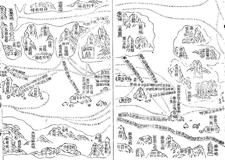
| Keywords: Zhenghe-sailing-chart.gif Part of the Wu bei zhi chart of Zheng He showing the west coast of India along the top Ceylon top right and Africa along the bottom The sailing directions are shown using zhen lu compass directions ążč ą░ą│ą╝ąĄąĮčé ąĮą░ą▓ąĖą│ą░čåąĖąŠąĮąĮąŠą╣ ą║ą░č čéčŗ ą║ą░č čéą░ ą ą░ąŠ ąÜčāąĮčÅ ąĖąĘ 菹ĮčåąĖą║ą╗ąŠą┐ąĄą┤ąĖąĖ ąŻą▒菹╣ čćąČąĖ ą┐ąŠą║ą░ąĘčŗą▓ą░čÄčēąĖą╣ ą▒ą░čüčüąĄą╣ąĮ ąÉč ą░ą▓ąĖą╣čüą║ąŠą│ąŠ ą╝ąŠč čÅ ąĪąĄą▓ąĄč čüą╗ąĄą▓ą░ ą▓ąŠčüč鹊ą║ ą▓ą▓ąĄč čģčā ąÆ ą┐č ą░ą▓ąŠą╝ ą▓ąĄč čģąĮąĄą╝ čāą│ą╗čā - ąŠčüčéč ąŠą▓ ą”ąĄą╣ą╗ąŠąĮ ķī½ĶśŁÕ▒▒’╝īąĪąĖą╗ą░ąĮčīčłą░ąĮčī - ąŠčüčéč ąŠą▓/ą│ąŠč ą░ ąĪąĖą╗ą░ąĮčī ; ą▓ ą┐č ą░ą▓ąŠą╝ ąĮąĖąČąĮąĄą╝ čāą│ą╗čā - ą┐ąŠč čé ą ą░ą╗ąĖąĮą┤ąĖ ķ║╗µ×ŚÕ ░ ą ą░ą╗ąĖąĮčīą┤ąĖ Wubei Zhi Early 15th century map Published in Wubei Zhi in 1628 PD-old-100 original upload log page en wikipedia Zhenghe-sailing-chart gif 2008-07-04 22 54 Chris55 1454├Ś1036├Ś 177834 bytes <nowiki>Part of the Wu bei zhi chart of Zheng He showing the west coast of India along the top Ceylon top right and Africa along the bottom The sailing directions are shown using zhen lu compass directions </nowiki> 15th-century maps of Africa Old maps of the Indian Subcontinent India in the 1400s Mao Kun map Maritime history of India India in the 1410s India in the 1420s India in the 1430s 15th-century maps of India | ||||